Calendar Icon
Oct 06, 2017
Person Bust Icon
By Keith McGuffey
![]() RSS
Submit a Story
RSS
Submit a Story
In the aftermath of Hurricane Harvey, Assistant Professor Dr. Richard Wood and Yijun Liao, a Ph.D. student in the University of Nebraska Department of Civil Engineering, assessed various wind-damaged structures and sites along the gulf coast of Texas. They collected remote sensing data and rapid visual assessments of various structures in Rockport and Port Aransas, Texas. These areas on the Texas gulf coast were subjected to winds in excess of 130 miles per hour (Category 4 Hurricane) and an estimated storm surge up to eight feet in late August.
Both researchers were part of the National Science Foundation’s Geotechnical Extreme Events Reconnaissance (GEER) Association. GEER conducts structural wind assessments in collaboration with the University of Notre Dame, University of Massachusetts at Amherst, University of South Alabama, and Louisiana State University. The team deployed light detection and ranging (LIDAR) and unmanned aerial systems (UAS) in the field to supplement visual assessment and allow for detailed scene reconstructions, which are ultimately used for more robust and objective structural damage detection.
Later this month, Dr. Wood and Ph.D. student Mohammad Ebrahim Mohammadi will return to the Rockport Texas area with collaborators from other universities, including West Texas A&M University (WTAMU). This follow-up team intends to collect extensive remote sensing data on light gauge cold-formed steel (CFS) structures using LIDAR and UAS platforms. CFS structures are of particular interest given their widespread construction throughout the country and their low variability in strength to better understand near surface wind patterns. This trip is being externally supported through WTAMU by a NSF Engineering for Natural Hazards (ENH) Rapid Award. All data collected will be publicly available on the National Science Foundation’s Natural Hazards Engineering Research Infrastructure Designsafe Cyber Infrastructure Platform. Select data sets from this and other reconnaissance efforts are featured on Dr. Wood’s research group webpage at https://se.unl.edu/point-cloud-visualization.
-

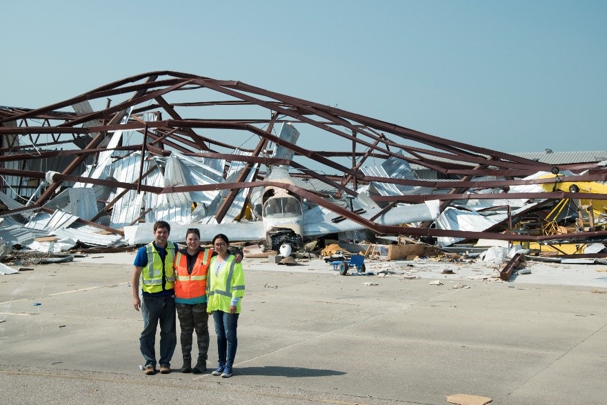
Team members assessing damage at the Aransas County Airport located in Rockport, Texas: (from left to right): Richard L. Wood (UNL), Kara D. Peterman (UMass Amherst), Yijun Liao (UNL PhD student). -

Yijun Liao collecting lidar measurements at a boat repair shop in Port Aransas, TX. -

Wind damage to CFS buildings at the Rockport Marine Inc., Rockport Texas. -

Airplane and hanger damage at Aransas County Airport, TX.
Submit a Story